* You are viewing Posts Tagged ‘Networks’
 The Early Modern Center of the University of California at Santa Barbara invites paper proposals for their eleventh annual conference, Early Modern Social Networks, 1500-1800. The conference will take place on March 16-17, 2012 at UCSB, and will feature keynote speakers Ann Blair (Harvard University), Elizabeth Eger (King’s College London), and James Raven (University of Essex). Possible topics include: knowledge networks, (such as the Royal society, libraries, salons, and coffeehouses); secret societies; clubs; literary coteries; epistolary correspondents; religious communities (including sacramental practices); print and publication networks; gift communities (patronage, the ward system); trade networks (such as the East India Company, the Royal Exchange, workers’ guilds, black markets); colonial administration; infrastructure expansion (the post, turnpikes, canals); financial organizations (stock markets, insurance); and others. The deadline for abstracts of 250-500 words in length is January 6, 2012. For further details and submission instructions, see the conference website.
James Brown
September 12, 2011
Conferences and Workshops, Events, Project Updates, Projects and Centres, Websites and Databases
Tags: CKCC, Eighteenth Century, Geography, Mapping the Republic of Letters, Networks, Seventeenth Century, Spatial Theory, The French Book Trade in Enlightenment Europe
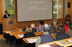
Miles Ogborn’s keynote.
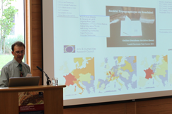
Simon Burrows from the FBTIEE project.
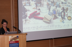
Giovanna Ceserani’s keynote.
Discussions continue over lunch.
Testing the demonstrators.
Mark Curran from the FBTIEE project.
The Project’s second international conference, International Geography: Comparative Studies, 1550-1700, took place at St Anne’s College last week on 5–7 September 2011. The event, which was attended by over sixty delegates, allowed twenty-seven emerging and established scholars to present conceptual papers and rich case studies – from Europe and the wider world – which both explored the organization of early modern intellectual activity across time and space, and attempted to implement and refine the concept of ‘intellectual geography’ as a new means of understanding and appreciating the spatial dimensions of intellectual exchange. On the final day, papers from several digital projects – including our good friends from CKCC (Huygens ING) and Mapping the Republic of Letters (Stanford) and new friends from The French Book Trade in Enlightenment Europe (Leeds) – shared some of the opportunities and challenges of capturing and visualizing intellectual geography electronically. Delegates were also treated to a drinks reception in the historic Museum of the History of Science (which incorporated a talk and tour of the intellectual geography of scientific objects), and enjoyed playing with software prototypes of the enormously impressive database of the STN archives prepared by the FBTIEE project, as well as of our own union catalogue of intellectual correspondence. Conference reports, videos, and other outputs will be available soon; in the meantime, for further information, including speaker profiles and abstracts, please visit the conference microsite. Details of our 2012 conference will be available soon.
James introduces the Project.
Anna Marie describes stibnite.
The Project was on the road again this week, this time at the venerable Reading Conference in Early Modern Studies, which this year took as its theme ‘Communication and Exchange’ (University of Reading, 18−20 July 2011). On Monday afternoon, a panel devoted to CofK comprised three interlocking papers. Project Coordinator James Brown provided an overview of the Project and its intellectual objectives, Research Fellow Anna Marie Roos delivered a wonderful case study of Martin Lister‘s hitherto unsung contributions to Newtonian telescopy, while Editor Kim McLean Fiander introduced our union catalogue of early modern correspondence and treated delegates to a sneak preview of its editorial and search interfaces. In the evening, Project Director Howard Hotson concluded our contribution with a plenary address on the multi-layered network of Samuel Hartlib. In a wide-ranging analysis, Howard recapitulated some of the broader objectives of the Project, before describing the way in which Hartlib’s legendary intelligencing both superimposed and reflected the pedagogical, diplomatic, commercial, and military networks engendered by the upheavals of the Thirty Years War. For more information about the conference, please download the programme (pdf).
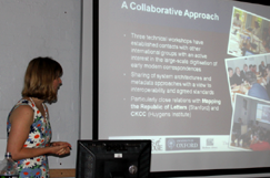
Kim introduces the catalogue.
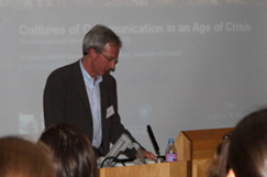
Howard's keynote on Hartlib.
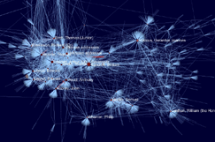
The CofK network at-a-glance.
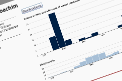
New interactive bar charts.
Further to our report on Scott Weingart‘s visit and presentation on Visualizing and Navigating the Republic of Letters, here’s a quick update on some of the fruits of his labours. During the week he was with us, Scott worked intensively with our developer community at BDLSS to implement some visual respresentations of the metadata assembled in our union catalogue of early modern correspondences, and the team produced some lovely deliverables within record time. The first are some revealing social network visualizations of the relationships between the 11,284 correspondents currently on the system, created with the Gephi graphics package. The second are some interactive, in-browser bar charts for display on person profile pages, displaying at-a-glance the number of letters sent, received, and mentioned in, created with the d3.js javascript library… and there’s more to come. At-a-glance representations such as these will radically improve the legibility and navigability of our records for end users, so a thank you to Scott for sharing his expertise with us. A public beta of the union catalogue will be available in the autumn.
Update: Preview some preliminary results
We are fortunate to have with us this week Scott Weingart, a former student of Robert A. Hatch and an up-and-coming visualization expert from Indiana University‘s Cyberinfrastructure for Network Science Center. Following on from a workshop at Mapping the Republic of Letters (Stanford) and a three-month stint at CKCC (Huygens Institute), Scott will be spending time with our union catalogue development team at BDLSS, raising awareness of the various techniques and technologies available for representing and visualizing large epistolary datasets. Scott kicked off his stay with a well-attended presentation on ‘Analyzing, Visualizing, and Navigating the Republic of Letters’ on Monday 11 July. In a two-part discussion, Scott provided a general introduction to the many uses and histories of visualizations, before describing in detail the various software packages and data formats necessary for implementation. Both of Scott’s talks can be watched again below; you can also ‘click along’ with his slides.
Part I: Introduction
Part II: Implementation
James Brown
July 13, 2011
Conferences and Workshops, Events, Project Updates
Tags: Databases, Digitization, Europe, Geography, Global, Networks, Spatial Theory, Visualization
We are pleased to announce that booking is now open for Intellectual Geography: Comparative Studies, 1550-1700, the second Project conference, which will take place at St Anne’s College, Oxford, on 5-7 September 2010. Organised by Howard Hotson, the event brings together case studies and digital projects exploring the roots of local, regional, and national intellectual traditions and networks within concrete features of political, economic, confessional, and physical geography. For provisional programme information, a steadily growing lists of speaker profiles and abstracts, and to book online, please visit the conference website. The deadline for registrations is Wednesay 31 August.
 The Early Modern Center of the University of California at Santa Barbara invites paper proposals for their eleventh annual conference, Early Modern Social Networks, 1500-1800. The conference will take place on March 16-17, 2012 at UCSB, and will feature keynote speakers Ann Blair (Harvard University), Elizabeth Eger (King’s College London), and James Raven (University of Essex). Possible topics include: knowledge networks, (such as the Royal society, libraries, salons, and coffeehouses); secret societies; clubs; literary coteries; epistolary correspondents; religious communities (including sacramental practices); print and publication networks; gift communities (patronage, the ward system); trade networks (such as the East India Company, the Royal Exchange, workers’ guilds, black markets); colonial administration; infrastructure expansion (the post, turnpikes, canals); financial organizations (stock markets, insurance); and others. The deadline for abstracts of 250-500 words in length is January 6, 2012. For further details and submission instructions, see the conference website.


 Join
Join 