* You are viewing Posts Tagged ‘Spatial Theory’
James Brown
January 30, 2012
Events, Front Page, Project Updates, Videos
Tags: CKCC, Databases, Digitization, Geography, Mapping the Republic of Letters, Networks, Spatial Theory, Union Catalogue, Union Catalogue News, Visualization

Videos of twenty-one papers and keynotes from our 2011 conference Intellectual Geography: Comparative Studies, 1550-1700 (Oxford, 5-7 September 2011) are now available on the conference website or via our Vimeo channel (with more hopefully to come). Organised by Howard Hotson, the event introduced and tested the novel concept of ‘intellectual geography’ as a means of appreciating and understanding the organisation of intellectual activity and the dissemination of ideas within space and across time, from the sixteenth to the eighteenth centuries. A taster – Miles Ogborn‘s keynote exploration of ‘What is Intellectual Geography?’ – is provided below. Happy viewing!
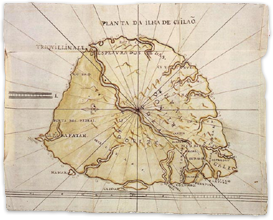 Further to the spatial excitements of our own recent gathering, a one-day conference on Imaginative Geographies: Travels of the Mind in Early Modern Europe will take place at the University of Bristol on Wednesday 28 September 2011. According to the organisers, the event will ‘explore correspondences between geography [and] literary and historical fields of research, to enable varied… cross-disciplinary discourses between scholars and students of the arts and sciences, and to enrich renaissance and early modern research with methodological and thematic diversity’. Panels are devoted to spiritual geographies, cartographic spaces, mapping the other, and mapping the familiar. For the full programme and to sign up please visit the conference website.
James Brown
September 12, 2011
Conferences and Workshops, Events, Project Updates, Projects and Centres, Websites and Databases
Tags: CKCC, Eighteenth Century, Geography, Mapping the Republic of Letters, Networks, Seventeenth Century, Spatial Theory, The French Book Trade in Enlightenment Europe
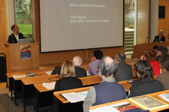
Miles Ogborn’s keynote.
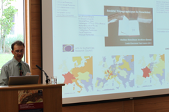
Simon Burrows from the FBTIEE project.
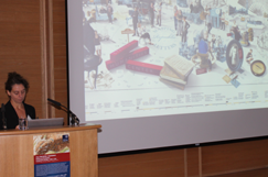
Giovanna Ceserani’s keynote.
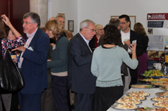
Discussions continue over lunch.
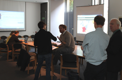
Testing the demonstrators.
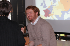
Mark Curran from the FBTIEE project.
The Project’s second international conference, International Geography: Comparative Studies, 1550-1700, took place at St Anne’s College last week on 5–7 September 2011. The event, which was attended by over sixty delegates, allowed twenty-seven emerging and established scholars to present conceptual papers and rich case studies – from Europe and the wider world – which both explored the organization of early modern intellectual activity across time and space, and attempted to implement and refine the concept of ‘intellectual geography’ as a new means of understanding and appreciating the spatial dimensions of intellectual exchange. On the final day, papers from several digital projects – including our good friends from CKCC (Huygens ING) and Mapping the Republic of Letters (Stanford) and new friends from The French Book Trade in Enlightenment Europe (Leeds) – shared some of the opportunities and challenges of capturing and visualizing intellectual geography electronically. Delegates were also treated to a drinks reception in the historic Museum of the History of Science (which incorporated a talk and tour of the intellectual geography of scientific objects), and enjoyed playing with software prototypes of the enormously impressive database of the STN archives prepared by the FBTIEE project, as well as of our own union catalogue of intellectual correspondence. Conference reports, videos, and other outputs will be available soon; in the meantime, for further information, including speaker profiles and abstracts, please visit the conference microsite. Details of our 2012 conference will be available soon.
James Brown
July 13, 2011
Conferences and Workshops, Events, Project Updates
Tags: Databases, Digitization, Europe, Geography, Global, Networks, Spatial Theory, Visualization
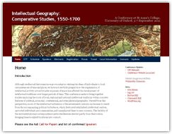
We are pleased to announce that booking is now open for Intellectual Geography: Comparative Studies, 1550-1700, the second Project conference, which will take place at St Anne’s College, Oxford, on 5-7 September 2010. Organised by Howard Hotson, the event brings together case studies and digital projects exploring the roots of local, regional, and national intellectual traditions and networks within concrete features of political, economic, confessional, and physical geography. For provisional programme information, a steadily growing lists of speaker profiles and abstracts, and to book online, please visit the conference website. The deadline for registrations is Wednesay 31 August.
James Brown
March 21, 2011
Conferences and Workshops, Events, Project Updates, Projects and Centres
Tags: CKCC, Digitization, Geography, Mapping the Republic of Letters, Networks, Spatial Theory, Union Catalogue, Visualization
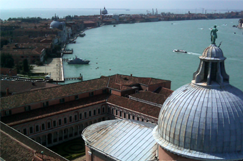
The Fondazione Giorgio Cini on San Giorgio Maggiore, with the island of Guidecca visible in the distance.
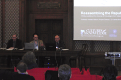
Our panel at the conference, shared with Charles van den Heuvel from CKCC (Huygens Institute).
Last week provided us with an opportunity to present the Project, specifically its union catalogue and associated editorial tools, at the international conference Mapping the Republic of Letters (Venice, 17–18 March 2011). Convened by the Stanford-based project of the same name (based at the Stanford Humanities Center), and held in and co-organised by the Fondazione Giorgio Cini on the island of San Giorgio Maggiore, the event showcased the work being undertaken by various individuals and projects worldwide to collate and represent digitally and spatially the early modern republic of letters. It also explored the research question of whether global exchanges of correspondences and other texts might be best conceived of as a state or as a network. While main sessions provided insights into the very wide range of approaches to this topic, associated meetings introduced the activities of the Milan-based research laboratory Density Design, and facilitated collaborative discussions amongst CofK, our hosts Mapping the Republic of Letters (Stanford), and CKCC (Huygens Institute), who also presented at the event. For further details, please see the conference webpage.
We will be presenting the Project at a wide range of correspondence-related events in 2011. For full details of our speaking schedule, please see the presentations page.
James Brown
February 06, 2010
Events
Tags: Geography, Spatial Theory
 An international, interdisciplinary conference on ‘From Space to Place: The Spatial Dimension in the History of Western Europe’ will take place at the German Historical Institute on 16-17 April 2010. Organised by the Centre for Research in History and Theory at Roehampton University, and featuring contributions from historians, geographers, anthropologists , archaeologists, and literary scholars, the conference will challenge the idea of place or space in history as an unreflected essentialist category linked to tradition and immutability, and will show how it was instead socially and culturally constructed, mediated, and contested. There will be broader reflections on historiography and spatial theory as well as case studies from a wide chronological span (including many from the medieval and early modern period). For programme and booking information see the conference website.


 Further to the spatial excitements of our own


 An international, interdisciplinary conference on ‘From Space to Place: The Spatial Dimension in the History of Western Europe’ will take place at the
 Join
Join 